
 Seonglae Cho
OpenDroneMap Usages
Drone Mapping Software - OpenDroneMap
We're building sustainable solutions for collecting, processing, analyzing and displaying aerial data while supporting the communities built around them. Our efforts are made possible by collaborations with key organizations, individuals and with the help of our growing community. A Node.js App and REST API to access MicMac.
https://www.opendronemap.org/
OpenDroneMap
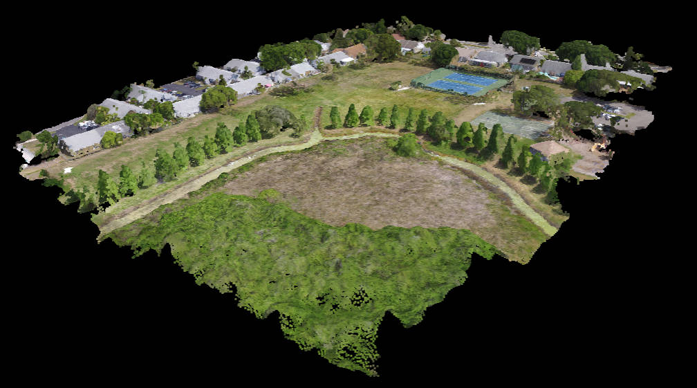
Creating the most sustainable drone mapping software with the friendliest community on earth. A command line toolkit to generate maps, point clouds, 3D models and DEMs from drone, balloon or kite images. 📷 User-friendly, commercial-grade software for processing aerial imagery.
https://github.com/OpenDroneMap
